 Videos
|
Videos |
 Posters Posters |

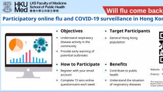
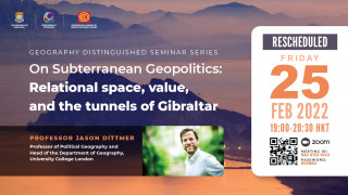
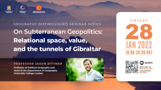
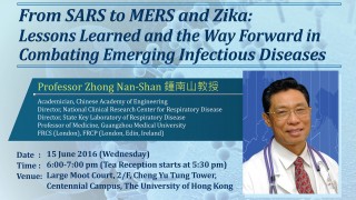
![]()
|
Videos |
Posters |
|
2024
|
2023
|
2022
|
2021
|
|
2020
|
2019
|
2018
|
2017
|
|
2016
|
2015
|
2014
|
2013
|
|
2012
|
2011
|
2010
|
2009
|
|
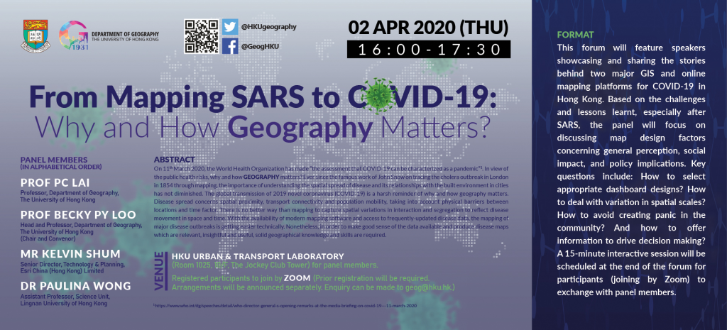
Admissions
|
Advocacy
|
|
Alumni & Giving
|
Architecture
|
|
Arts
|
Business & Economics
|
|
Campus Environment
|
Ceremonies
|
|
Education
|
eLearning
|
|
Experiential Learning
|
Health, Medicine & Dentistry
|
|
HKU News
|
HKU Showreel
|
|
Info & Support
|
Innovation & Entrepreneurship
|
|
Law
|
Lectures & Conferences
|
|
People
|
Publications
|
|
Research Stories
|
Science, Technology & Engineering
|
|
Seasonal
|
Social Sciences
|
|
Student Works
|
Your session will expire and automatically logout at 14:25. Please choose "Keep connection alive" to extend your session or choose "Logout" to immediately logout of the system.
 SHOW RESULTS


Post a New Comment